High-Tech Software House
(5.0)

In the series of Case Study blogs, we will bring you closer to some interesting projects. We will present the client and their problem, as well as the solution diagram, and results! Of course, as much as we can, we care about our clients and their privacy.
So, without further ado, we invite you to familiarize yourself with the first installment of our series, there will be plenty to read!
Today we're taking a deeper look at a software project we are particularly proud of. Firstly, this project is related to environmental protection. At Flyps we believe that software solutions can and should be used to help change the world for the better.
Secondly, Flyps was entrusted to build an end-to-end solution, and we greatly appreciate the opportunity to provide a full stack of services for our client.
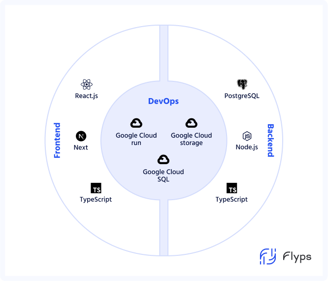
Thanks to taking care of the entire project, both from the frontend, backend, and DevOps side, we can approach the construction of a software solution holistically. Flyps prides itself on having experts who complement each other perfectly, ensuring full tech stack coverage.
Our client is a USA-based company, related to the environmental protection industry and supporting these activities throughout the country. It has existed since 2022, and thanks to innovative ideas for a software solution, it is already a serious player in the huge North American market. They are widely recognized among environmental stakeholders in the US, with sympathizers and supporters at both state and federal levels.
The main task of their software solutions is to support the representatives of governmental agencies for environmental protection in their work. This applies both to project preparation and record-keeping activities, as well as to more direct activities such as identifying hazards and warning against the risk of environmental disasters. To achieve its goals, the client needed software that:
An additional challenge was the fact that Flyps took over the project from another contractor who was unable to provide a solution that would satisfy the client. There was a need for skilled experts from high-tech software house to prepare a software solution that met all of the client’s requirements.
From the very beginning of the project, we were cooperating with a client in refining product specification, to make sure we were optimally building the MVP. Due to the project's specificity and the challenges ahead of us, a thorough study of the technological and business needs was more than necessary. Since the project required flexibility, we decided to use storyboards during its creation. Thanks to it we were able to create a library of testable components that can be used as building blocks for more complex user interfaces. By taking this step we ensured the highest quality of UX/UI of the entire website.
As for the backend architecture, all the backend interactions were delegated to an external library that was maintained by a separate team to increase velocity. Thanks to this procedure, Flyps was able to approach the construction of the project holistically and take care of every part of it, and daily communication between the teams helped to maintain the coherence of the entire solution.
To ensure the smoothest possible implementation of individual elements, we implemented a very tight QA loop with regression & break testing for each new feature or change implemented.
Some solution highlights to share:

Full stack solution of environmental protection platform.
Thanks to our solutions we built a platform that:
Want to speed up your platform or another software solution? Or build something completely from scratch? This is a good time to contact us at [email protected] and discuss your needs and challenges. We guarantee that together we will find a solution.
See our tech insights
Like our satisfied customers from many industries